The Queen’s Gallery at Buckingham Palace has a display of Leonardo da Vinci’s drawings, drawn from a folio collection obtained by Charles II in the 17th century and only made publicly available in the early 20th century.
I saw the exhibit while I was in London last week.
I had not previously had my attention focused on his cartography. Seeing them close up and in real life, however, impressed upon me how beautiful and informative these 15th century examples of cartography could be.
Take his map of Imola for example (click for large version):
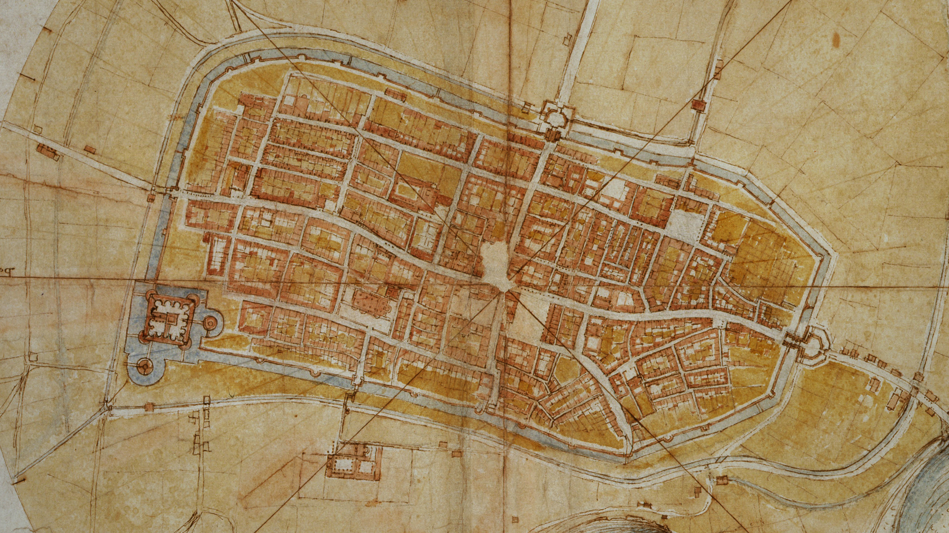
You could pretty much just plug this directly into a D&D campaign, and I absolutely love the aesthetic of it. Check out this video for how he made it:
You might also check out Random GM Tips: Visualizing City Block Maps.
There’s also this map of Valdichiana:
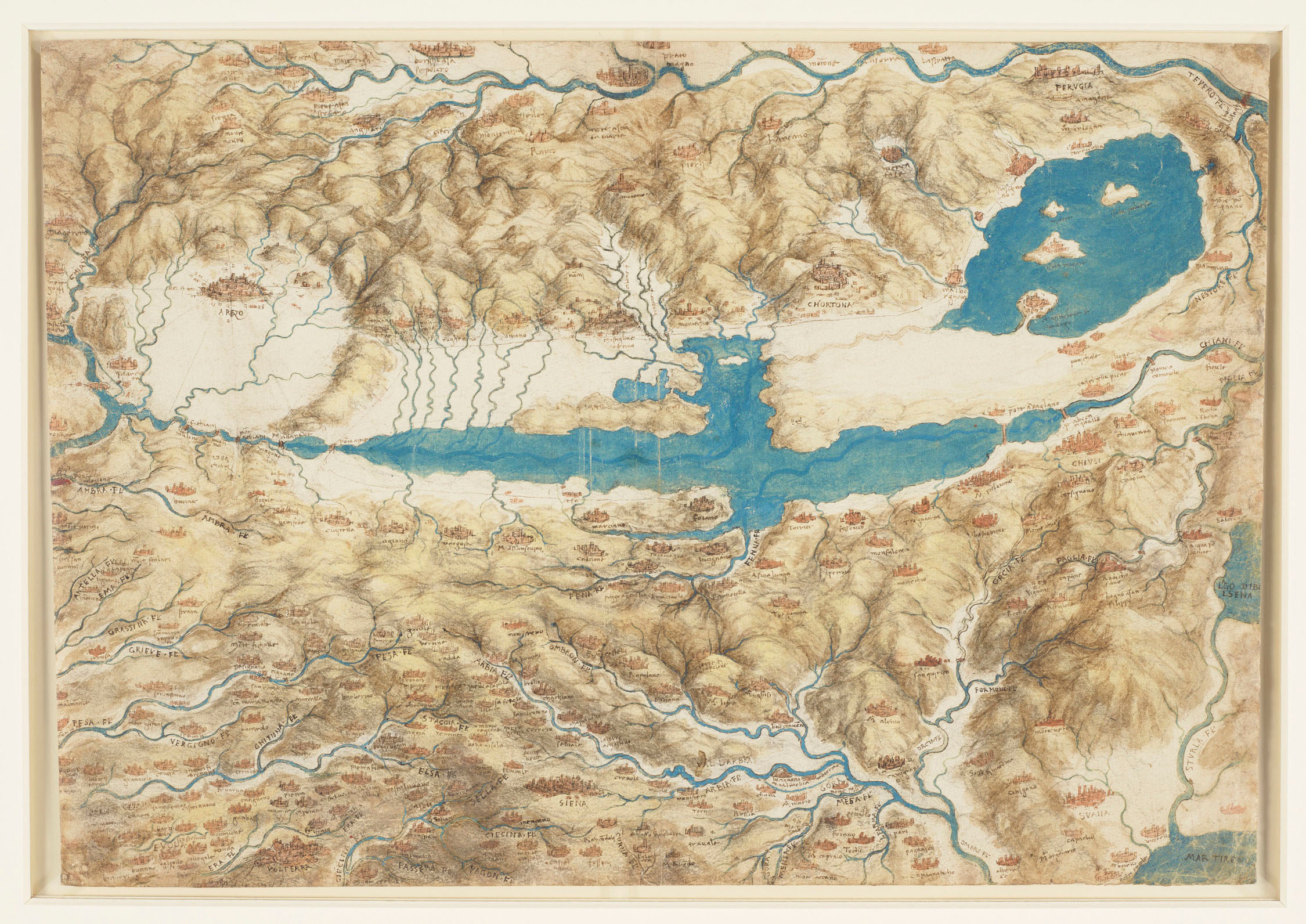
I strongly encourage you to click-through to appreciate all the detail in this map. (There’s even more when you see it in real life.)
I’m currently very tempted to use this map for the version of Loch Gloomen in my Blackmoor open table.


Very cool!—I don’t recall learning/reading about DaVinci’s cartographic work previously, either. How many pieces were in the exhibit, and did you take any other pictures, Justin?
Allan.