The Alexandrian

Posts tagged ‘d&d’

Skulls from the Sedlec Ossuary

DISCUSSING
In the Shadow of the Spire – Session 39A: Chamber of Bone

Tee felt the ratlings throw their weight against the door, but she was able to hold it against their charge.

Tee signaled for the others to back up out of the chamber of bone, bracing the door against another pounding from the ratlings on the other side. Then she jumped back herself and, as the ratlings charged through, shot out the pillars of bone.

A cascade of bone collapsed. Several of the ratlings, pouring into the room, were struck about the heads and shoulders; one was even knocked unconscious by a particularly heavy chunk of pelvis. Others slipped and tripped, their feet turned treacherously by the shifting mass beneath their feet.

In Rulings in Practice: Traps, I said that you’ll know you have the balance right when the players start harvesting supplies from the traps or finding other ways of turning them to their advantage. In practice, this is probably a specific application of a wider principle: The more time players spend creatively interacting with stuff in the game world, the more you’ll know that (a) you’re succeeding in including cool stuff that’s bringing the world to vivid life and (b) that you’ve got great players.

Conversely, if you’re a player, pay attention to your character’s surroundings and look for opportunities to turn them to your advantage.

In this case, my players were very on top of things. Here’s what the key for this room looked like:

AREA 8 – BONE CHAMBER

The walls of this chamber are stacked high with bones — human bones. They have been arranged in intricate and detailed patterns with an effect which is entirely ghastly. Four pillars of interlocking skulls and femus reach from the floor to the ceiling.

Handout: The Bone Chamber

Bone Pillars: Any blow to one of these pillars (AC 3) will cause it to collapse, causing a cascade of bone. Characters within 5 ft. of the pillar must make a Reflex save (DC 15). On a failure, they are dazed and must make a Fortitude save (DC 12) to avoid being stunned.

Swinging Weapons: Characters who swing weapons within range of a bone pillar must succeed on a Reflex save (DC 10) to avoid striking the pillar. Alternatively, they can carefully avoid the pillar while making their attack — this requires no saving throw, but does impose a -2 penalty to their attack rolls.

(This room was inspired by the Sedlec Ossuary. The handout consisted of photos from the actual ossuary, which you can see in the linked campaign log.)

In addition to just being a creepy room, I’d intended for the ratlings to take advantage of the environmental hazard. The PCs, however, were savvy enough to be suspicious of the ones, realize they were precarious, and then almost immediately turn the situation to their own advantage.

In this case, the idea of the bone piles being precarious had occurred to me during prep. But the key thing is just including the bone piles as set dressing in the first place. Even if I didn’t have an answer prepped, a nigh identical scene could have emerged simply from the players asking, “Do the piles look unstable?”

Of course, it’s not just the bone stacks they’re using here. They start by using the door to control the start of the campaign, giving them time to estalblish their tactical position (as we’ve also discussed in Running the Campaign: Battles at the Door). And then, at the end of the fight, Agnarr rips the crossbow bolts out of his shoulder and uses them as improvised weapons!

When you fill your description of the world with interesting details, you’re providing the raw ingredients. Once you’ve done that, it become very easy for the whole group to start cooking.

Campaign Journal: Session 39BRunning the Campaign: Clues Linking Scenarios
In the Shadow of the Spire: Index

Ptolus - In the Shadow of the Spire
IN THE SHADOW OF THE SPIRE

SESSION 39A: CHAMBER OF BONE

June 14th, 2009
The 22nd Day of Kadal in the 790th Year of the Seyrunian Dynasty

Sepulcher of Skulls

They headed north along the tunnel. It quickly straightened out… and then dumped into an open sewer channel.

Agnarr stooped to the ground and quickly examined it for tracks. “They’re wading.”

Elestra wrinkled her nose. “That’s disgusting.”

But there was no way to follow the ratlings’ trail through the sewage. So they backtracked to the T-intersection. There they pulled Silion’s body out of Tee’s bag of holding, placed a black hood over her head, and had Nasira use her holy touch to heal her wounds.

Silion resisted their questioning, at first feigning unconsciousness and then proving stubbornly intransigent. “I don’t talk to humans,” she snarled.

“She’s not human,” Elestra said, pointing unhelpfully to Tee.

“She can’t actually see me,” Tee snapped. “And I’d like to keep it that way.”

“We could cut her whiskers off,” Agnarr suggested. Silion snarled.

“Last chance,” Tee said. “Where are the children?”

Silion laughed. “You’re too late! Malleck has them!”

Tee slammed a dagger into her heart. They re-secured the collar and stuck her back in the bag.

“Maybe her tongue will be looser next time we wake her up,” Ranthir said.

“If there is a next time,” Tee said darkly.

CHAMBER OF BONE

The northern tunnel was effectively a dead end for the time being, so they turned south. In this direction the tunnel twisted several times, and then opened into a cramped chamber stacked high with bones – human bones. The bones had been arranged in intricate and detailed patterns with an effect that was entirely ghastly. Four pillars of interlocking skulls and femurs reached from the floor to the ceiling, supporting a vaulting horror of skeletal remains.

Tee saw that these pillars were particularly precarious and warned the others to be careful. They hung back while she proceeded cautiously into the midst of the bones. The tunnel continued further to the south, but Tee took the time to carefully examine the ghastly nooks and crannies of the chamber. In the far corner she found a section of bones that could be pulled free, revealing a hidden door in the wall beyond.

She opened the door just in time to see half a dozen ratlings charging down a long hall toward her. With lightning reflexes she instinctively slammed the door shut again and threw her shoulder against it. She felt the ratlings throw their weight against it, but she was able to hold it against their charge.

Tee signaled for the others to back up out of the chamber of bone, holding the door against another pounding from the ratlings on the other side. Then she jumped back herself and, as the ratlings charged through, shot out the pillars of bone.

A cascade of bone collapsed. Several of the ratlings, pouring into the room, were struck about the heads and shoulders; one was even knocked unconscious by a particularly heavy chunk of pelvis. Others slipped and tripped, their feet turned treacherously by the shifting mass beneath their feet.

Agnarr and Tor had positioned themselves in each of the narrow tunnels leading out of the chamber and the brunt of the ratling charge had been disrupted. They easily held their ground against the dazed and confused ratlings… Or, at least, they did until a ratbrute came trundling around into the southern corridor behind Tor’s defensive position.

The ratbrute thrust his greatsword at Elestra (who had thought herself perfectly safe behind Tor’s broad shoulders). She gave a little cry of outrage as she ducked out of the way. Nasira, standing next to her, backpedaled rapidly towards Tor.

With a flurry of his blade, however, Tor finished off the ratlings facing him and turned to face the ratbrute – which fell back towards a larger chamber to the south in the hope of getting a better (and wider) footing. Tor denied it the opportunity – pursuing it down the hall with quick steps; parrying its large, awkward blade; and slicing it up with vicious, lightning-spiked blows.

The two remaining ratlings in the chamber of bone – facing Agnarr and seeing what had happened to their comrades – fell back through the secret door. Agnarr gave pursuit, ripping an axe from his bandolier and hurling it from the door. The axe caught one of the ratlings in the shoulder, but the ratling – hissing and snarling in rage – ripped the blade out of its own body and hurled it back at Agnarr, catching him in the shoulder, as well.

Agnarr fell back a step, giving both ratlings an opportunity to draw hand crossbows. They fired, both striking Agnarr in the opposite shoulder.

Agnarr roared. He charged down the length of the hall, ripped the bolts out of his shoulders, shoving one into the heart of a ratling and plunging the other into the eye socket of the second.

Running the Campaign: Using Scenery & Turning Traps Campaign Journal: Session 39B
In the Shadow of the Spire: Index

Wizard gazing at a floating tower wreathed in purple lightning (Artist: T Studio)

A hexcrawl is one way of looking at a game world.

Like other scenario and campaign structures, a hexcrawl can be broadly understood as a method for organizing prepped material paired to a complementary procedure of play: A dungeon procedure provides structure for PCs moving between rooms and exploring their contents, and it’s logically paired to a prep structure in which rooms are positioned on a map (to make them easy to reference) and keyed with the information needed to explore them.

A hexcrawl, similarly, creates a map of the world broken down into hexes because those hexes provide a convenient structure for keying content and managing overland exploration.

But one must not mistake the map for the territory.

One way to think about this is to consider the howling wilderness of the typical hex: We generally key no more than a single point of interest in each hex. But whether we’re talking about a 5-mile hex, a 6-mile hex, or the Alexandrian 12-mile hex, if there was really only one point of interest in a hex, it would mean a vast and desolate place.

Lay a hex grid to scale over a map of your local county, shire, or district and you’ll see what I mean. For example, consider Brown County in Minnesota, which I picked by basically clicking randomly on a map. It would consist of roughly eight 12-mile hexes, but it contains seven cities, a couple dozen townships, fifteen major lakes, three major parks and wildlife preserves, multiple scientific outposts, and forty different sites on the National Register of Historic Places. Whichever eight of those you pick, you’re obviously going to be leaving a lot of stuff out of your hex key.

That’s how the real world works. It’s also how your game world works: Whether consciously or otherwise, you’re choosing to key the most important or significant thing in each hex, while overlooking the others. This isn’t a problem, of course, unless you forget the conceit and begin to believe that what you’ve keyed is everything the game world has to offer.

(This is also why the Alexandrian Hexcrawl uses random encounters to procedurally generate new locations — e.g., lairs — on the hexmap. The more time the players spend in a particular region, the more of these “overlooked” details they’ll have a chance to discover precisely in the area of the game world they’re spending the most time in.)

The hexcrawl also has a procedural bias: The material is structured and keyed for the PCs to discover it through geographical exploration (e.g., “We walk north until we see something interesting.”). But this is not, of course, the only way that PCs can explore or interact with an area. It’s also pretty easy to imagine interesting elements of the game world that are largely or entirely inaccessible to simple geographic movement.

What I’ve found useful is to think of different structures as being “layers” of the game world. A hexmap, for example, is one “layer” — one method of keying and describing the game world — and it’s often more than enough to run an entire campaign. But it’s not a complete picture of the game world, and you can add more layers, each describing the world in a different way and each conducive to different types of PC actions.

Furthermore, since these layers are all describing the same world, they will also overlap or intersect with each other in different ways. While the PCs are exploring and interacting with the world in one way, you’ll be able to use the appropriate layer to run the game for them. Then, when they discover something new and/or set a new goal that will lead them to begin exploring the world in a new way, you’ll be able to shift to a new layer — a different scenario or campaign structure — to adjudicate what happens next.

And you can also, as the GM, design your world with these phase shifts in mind!

NODE-BASED LAYER

For example, consider node-based scenario design, in which nodes are linked to each other by clues.

Each node is a person, organization, event, activity, or, crucially, location. This means that each location keyed to your hexmap can also be thought of as a node and linked to other locations on your hexmap (i.e., other nodes) via clues.

For example, the hobgoblin bandits lairing in the ruins of the Black Baron’s Keep may have been sent by the Necromancer to spy on the elves of Silverwood. When keying the Black Baron’s Keep, therefore, it would be perfectly natural to include clues pointing to both the elven village in Silverwood and the Necromancer’s Tower.

If you want to start experimenting with this technique in your own hexcrawls, I recommend getting started with some simple loops:

Node-based scenario design diagram, showing nodes A,B,C, and D, each with three clues pointing to the other three nodes.

The Black Baron’s Keep has clues pointing to the Necromancer’s Tower, the Elven Village, and the Hobgoblin Village.

Meanwhile, the Necromancer’s Tower has clues pointing to the Black Baron’s Keep, the Elven Village, and the Hobgoblin Village.

And so forth.

The advantage of this design is that it creates compact little scenarios that can be naturally explored no matter which of the nodes the PCs encounter first: Whether they’re attracted by the strange lights in the Black Baron’s Keep, hear reports of hobgoblin raids from the elves of Silverwood, or stumble across the hobgoblin village, they’ll be able to follow the clues and discover the other nodes.

To add additional complexity to these simple setups, consider linking a single node to multiple loops. For example, spying on the Silverwood may be only one of the Necromancer’s current schemes, with her tower acting as a sort of crossroads between different node-based scenarios.

As you become more comfortable with adding node-based layers to your hexcrawl, you’ll likely end up gravitating towards freeform design in the cloud, with your various hex-keyed locations pointing to each other freely in whatever manner makes the most sense. In doing so, you may also discover that you can use these same techniques without necessarily creating fully robust node-based scenarios.

What I mean is that, with the hexcrawl structure as a backstop, you don’t need to strictly obey the Three Clue Rule or Inverted Three Clue Rule. Or, to put it more simply: You can include a single clue from Hex A to Hex B, and it’s just fine if the PCs don’t find it, because the hexcrawl structure means they can just geographically navigate their way to Hex B with or without the clue.

Note that you can also plant clues into other structures of your hexcrawl campaign:

  • Rumor tables, for example, are basically just big lists of free-ranging clues.
  • Random encounters can also include clues pointing to hex locations. (This can even be true of procedurally generated clues. Tracks, for example, are inherently clues that point you to the locations that creatures are coming from or going to.)
  • Even random treasure can be used to plant clues. (Random treasure maps are a classic example of this.)

All of these links add depth to your campaign. They actually feed back into the hexcrawl structure itself, giving the PCs’ the information they need to set goals that will guide their exploration, allowing them to travel with purpose instead of just wandering around the map aimlessly.

However, we’re still only scratching the surface here, because so far we’ve only been linking locations that also appear in our hex key (and are, therefore, also accessible via the hexcrawl). There’s no reason that we need to limit ourselves like this: Locations discovered through the hexcrawl can link us to nodes — people, events, organizations, activities, and even other locations — that DON’T appear in the hex key and could never be discovered by simply moving around the hex map. They literally exist on a completely separate “layer” of your campaign world.

I frequently find this approach useful for cities located in my hexcrawls. Like Maernath, for example:

Sample hexmap: City of Maernth along the King's Road

Maernath might be the PCs’ homebase for the hexcrawl, or it might be a city they discover while exploring the region. Either way, it’s easy to see how the city itself could be encountered through the hexcrawl structure.

But simply seeing a city on the horizon isn’t going to reveal all of its secrets to you. For example, what if a scion of one of the noble families is collaborating with the Necromancer? They might be just one node in a much larger conspiracy scenario that’s infesting the city, but the PCs are unlikely to stumble onto this conspiracy just because they walked through the city gates.

(What I also like about this is that it connects the urban environment to the surrounding wilderness, and you can obviously do the reverse, too. It weaves your campaign together, not only adding depth, but also making everything feel interconnected.)

Another fun technique is to stock your hexcrawl with rituals, allowing the PCs to piece together the clues and supplies they need to figure out what, where, and possibly when they need to perform the ritual. These rituals, in turn, might unlock unique spells and abilities; empower magic items; summon mystic allies; or even open portals to extradimensional adventuring sites.

The region described by your hexcrawl might also include traveling elements, like a touring carnival, merchant caravan, or mystic phoenix. These are, obviously, not keyed to specific locations. You might include such elements on your random encounter table as one way of integrating them into the hexcrawl structure, but node-based design can provide another path for the PCs to discover them and track them down.

Note: You can also use node-based scenario design to provide links to location nodes far away from the region covered by the hexcrawl (e.g., you’ll need to take a ship south to pursue the political backing of the local privateers; or you’ll need to go to the Imperial City to follow the Cult of the Black Eye). This isn’t quite same thing as thinking of the campaign in terms of “layers,” but it IS an example of how you can use shifts in structure to present or handle different types of scenarios. Your structure should never feel like a straitjacket; it should be a tool that liberates you.

Go to Part 2: Pointcrawl Layers

Back to Hexcrawls

Young man walking through a meadow with magical clouds (Artist: grandfailure)

When a GM makes the transition from dungeons or scene-based play to wilderness travel, it’s not unusual for them to suddenly start struggling with describing that travel. The two most common afflictions are long-and-boring (with too much detail that’s poorly presented and neither interesting nor important) or short-and-boring (often bland, generic descriptions that fail to bring the journey to life).

What we want is to capture the epic grandeur of Tolkien’s Middle Earth; to bring our waterways to vivid life like Twain’s Mississippi; to make every corner of the world bristle with adventure like the Mediterranean Sea in Homer’s Odyssey.

But achieving these lofty aspirations can prove elusive for a couple of reasons.

First, whether we’re using hexcrawls, routes, or some other method to run our travel, these are all new procedures with new tools to learn. These can be studied, of course, but mastering them will require practice and experience, so it’s only to be expected that we’ll struggle a bit putting these into practice for the first time. “Whoops, I forgot to roll for a random encounter” and “Wait, what speed did you want to travel at?” aren’t exactly conducive to smooth, immersive descriptions.

Meanwhile, the very nature of time itself has changed.

In a dungeon, for example, pretty much everything is resolved in now time. As defined in the Art of Pacing, this is when the GM is basically describing events “as they happen” and the players are making every decision for their characters.

Wilderness travel, on the other hand, usually happens in abstract time, taking the form of eliding narration: “You wind you way through the canyons of the Opal Mesas for three days before turning south…” or “The afternoon passes quickly as you sail downstream, and as dusk approaches you can see thunderstorms on the horizon…”

At first glance, this seems quite simple. In practice, however, it unleashes a slew of new things we never had to consider before, particularly if we’re expecting the PCs to make meaningful navigational decisions along the way: How much time should be covered by our description? What events and activities can we / should we skip past entirely? What should be included in the description? When/how should the players be making decisions?

For example, how detailed should our description of the Opal Mesas be? And should it be the players’ decision to turn south after traveling three days through the Opal Mesas? Probably… unless they actually make that decision before you started the travel narration (e.g., “Okay, according to our maps we’re going to travel through the mesas and then turn south”). And, either way, what about deciding exactly which canyons to follow through the mesas? Should we be having the PCs make those decisions? Or maybe we should ask once per hex which direction they want to go?

These questions don’t necessarily have obvious answers. Worse yet, the answers will frequently CHANGE from one journey to the next. In fact, even the next time the PCs travel through the Opal Mesas you might have a completely different set of answers based on the circumstances of the trip.

Ultimately, describing travel — and doing so effectively — is more an art than a science. There is no one true way to describe the sun-kissed hills at dusk, the refreshing cool breezes that wash across your face as you head down into the Verdant Vale, or the thick cobwebs draped across the upper boughs of the Bleak Wood.

But there is a mental model that I use — a framework that helps me make sure I’m communicating clearly.

IDENTIFY THE VECTOR

First you need to identify WHAT you’re actually describing.

“Well, obviously I’m describing the journey.”

Sure. But probably not the whole thing all at once, particularly if the PCs are going to be making navigational choices along the way.

So what part of the journey are you describing right now?

I think of this as the group’s vector, but you might also think of it as a “segment” (of the journey) or a “container” (that you’re going to be filling up with your description). In short, look at where the PCs currently are and their intended/actual direction of travel. Looking along that line, you want to figure out where the next interruption will take place. That will give you the endpoint of the group’s current vector, and then you’ll know exactly what chunk of travel you need to describe.

Another way of thinking about the interruption is that it’s the next point along the vector where the players either will or might want to make a meaningful choice. Interruptions can be many different things:

  • Terrain. A change in terrain — e.g., arriving at the forest; entering the Mire of Despair; emerging from the Opal Mesas — provides new navigational information to the players, which makes it likely, particularly if this is their first time exploring this region, that they’ll want to stop, try to figure out where they are, and possibly choose to head in a new direction.
  • Landmark. Similarly, spotting a landmark is often a point where the PCs will need to make a choice — e.g., You see a castle off to the west. (Do they want to go check it out?)
  • Destination. If the PCs are heading to a specific location, then obviously their journey will end when they reach it.
  • Getting Lost. Or, more accurately, the point where the PCs realize that they’re lost. They’ll obviously want to stop, try to get their bearings, and then make a new navigational choice.
  • Random Encounter. In most cases, when a random encounter is generated, you’ll want to give the players a chance to react to and/or interact with whatever the encounter is.
  • End of Watch. Since the PCs need to choose which watch actions they’re going to perform during each watch, you’ll naturally want to stop at the end of each watch so that they can declare those actions… except this is a trap. The choice of a new watch action is often not meaningful at all, because it’s overwhelmingly likely that, for example, the navigator will continue being the navigator. This is why you want to instead establish standing orders for the expedition: It extends the vector so that you can’t get stuck in a long-and-boring cycle of minutia.
  • End of Day. Another natural and regular endpoint is the end of the day. Although there are situations in which a vector will end up being longer than a single day, it’s a good default to aim for when in doubt or just getting started. A full day of travel will give you a nice chunk of resolution; settling in around the campfire each night is a logical place for the PCs to compare notes, do some bookkeeping, and prep for the new day; and if something like a random encounter interrupts the day, it’s easy to spot that and then set up another vector aiming for sunset.

Some of these interruptions, like a random encounter, will basically demand the vector’s end. Others can be more situational, and you’ll need to get in sync with your group: Are they in nitty-gritty exploration in an area with lots of new landmarks and terrain? Then you might have a lot of very short vectors. On the other hand, are they traveling a well-known route? Then you probably don’t have to stop when they leave the Emerald Wood — both you and them know where they’re going!

VECTOR PROCEDURE

So, to be clear, what you’re doing is:

  1. Identifying the group’s intentions (i.e., their travel plans).
  2. Resolving your hexcrawl procedure
  3. … until you reach an interruption.

And that’s the vector you’re going to describe.

The travel plan might simply be the intended direction of travel and travel pace, in which case the vector is quite literal (it’s a line pointing in that direction). However, in some cases, particularly if they’re traveling a familiar route, the players will declare a more complicated intention — e.g., “We’ll travel through the Emerald Wood, then turn southwest when we hit the Ochre Grasslands on the other side.” Assuming nothing else interrupts their intention, you can continue resolving your hexcrawl procedure through that predetermined navigational choice until you reach a meaningful interruption and identify the true end of the current segment.

In practice, I often look ahead and figure out what the end of the vector will be if everything goes “right” for the PCs. This lets me identify a “chunk” of travel that’s going to be fed through the hexcrawl procedure, which — with a little bit of mastery and experience — lets me batch up some tasks (i.e., making multiple random encounter checks in a single roll) resolve things more quickly and efficiently.

Resolving the chunk, of course, may reveal an additional interruption (e.g., the random encounter(s) I rolled), in which case the vector will end sooner. Which is, of course, just fine. Jot down a note of any pending resolutions (i.e., future random encounters), which also conveniently give you a head start when the next vector kicks off.

DESCRIBING THE VECTOR

With your vector in hand (which, in practice, will be a much quicker process than the detailed discussion above might lead you to believe), it’s now time to describe that vector to your players.

The foundation of your description is Terrain + Distance + Time.

Distance and time are easy: You know where the vector started and you know where it ends. Your travel rules will tell you how long it took to get from one point to the other.

For complex vector, you may also want to make a note — mental or otherwise — of the timing for milestones along the way (e.g., they reach the Emerald Forest after three hours and they arrive at the Atharan River after seven). These will help you sequence and provide a light structure for your description.

Terrain is, of course, sourced from your hexmap. Hexcrawl Tools: Spotting Distances provides a detailed breakdown for this, but here are the key points I’m usually thinking about:

  • The PCs can see the terrain in their current hex.
  • In relatively open terrains (e.g., plains) you might mention the terrain of neighboring hexes on the horizon. (This will be particularly true if the PCs are biased in the hex.)
  • Heights can often let the PCs see a lot farther, although it’s usually unreliable. (Being high in the mountains, for example, can let you see a long way… or it can completely block your line of sight.) There are rules for seeking a vantage point that cover this, but as a rule of thumb you might once per day describe terrain and landmarks in hexes made visible by the heights.

In practice, this foundation covers most of what you need to describe:

Crossing through the tall, amber-colored grasses of the plains you reach the Emerald Forest in about three hours. You travel through the forest for the rest of the day and, near nightfall, you hear the roaring rapids of the Atharan River ahead.

But there are two other elements you’ll want to use to flesh out your descriptions: Landmarks and Unkeyed Details.

Landmarks are locations visible to anyone passing through a hex. Some landmarks, including mountains, will be visible from multiple hexes away (and you should make sure these are indicated on your hexmap for easy reference).

Some landmarks may function as interruptions that end the vector, but others will just be additional milestones for the journey.

Tip: An advanced technique here is to mention a landmark (e.g., “Around mid-afternoon you spot the ruins of an old castle on top of a tall hill a couple miles off to your left”) and then pause for just a beat. Not so long as to become expectant, but just a subtle break that gives players the space to say, “Let’s go check it out!” before you continue describing their journey forward.

Figuring out which landmarks should be interruptions, which ones you should give space for a reaction, and which are best just describe in passing (probably because the PCs have already come this way before and are expecting to pass the castle ruins) is something you’ll get a feel for.

When in doubt, it rarely hurts to just ask, “Do you want to check out the castle or keep heading east?” But, in my opinion, you don’t want your players to think that you’re pushing the castle on them. It’s more fun when they feel in control of their exploration.

Unkeyed Details are all the things in your game world that don’t appear in your prep notes: You don’t key the trees. Or the streams. Or every minor details of the terrain.

The key thing to understand here is that if we interpreted a hex in our hexcrawl as if it only contained the keyed point of interest, then it would be a vast howling emptiness. Think about everything interesting within six miles of where you’re reading this. Imagine a GM picking out the single most interesting thing in that area and adding it to their key. Now imagine that same GM describing a group of PCs traveling through the area. See how much stuff they’d miss if they only described what was in their key?

In short, your hexmap doesn’t include every road or river. Hexcrawls are often located out on unexplored frontiers, but if you have a hex keyed as farmland, the unkeyed scenery could even include passing by two or three small villages per hex. (This would obviously vary by locale, but in both medieval France and Qing Dynasty China, the villages were three to four miles apart.)

So what you want to do is add a light spicing of this unkeyed scenery into your descriptions: Describe them splashing through a small stream. Or following an old game trail that leads them down into the river valley.

It might be useful to think of these details as breathing life into a generic terrain symbol. It’s certainly these little details that will make your game world feel like a real and living place to your players.

Note that you don’t need to remember all these details: They’re unimportant by their very nature. Next time you might instead describe a glade dappled by sunlight that the PCs pass through on their way to the Atharan River instead of a game trail, and that’s just fine. You don’t need to memorize these fleeting moments any more than you need to memorize every stitch in your favorite quilt.

(The exception is when an unkeyed detail becomes important because the PCs choose to focus their attention on it. When that happens, just add it to your key. For example, they might say something like, “Let’s find that old game trail we followed last time!” Or they might decide to stop in one of the nondescript villages they’ve been passing along the road and rent a room at the local inn… where one of the PCs ends up falling in love with the innkeeper’s handsome son. They eventually end up getting married, the PC inherits the inn, and then their husband is tragically killed in an orc attack. Yeah… You should probably add that to your notes.)

Unkeyed details can also include minor travel activities: Stopping for a meal. Checking the map. The ranger finding that game trail. These are great because they protagonize the PCs and makes them a concrete part of the journey. You can take cues from the groups’ watch actions and make sure to spread the spotlight around. (Not every PC needs to be described as doing something in every vector, but over the course of several vectors everybody should get a turn.)

So, to sum this all up: Set your foundation with terrain + distance + time. Identify the landmarks the PCs will pass along the way and place them in sequence. Then lightly spice with evocative details to taste.

As you cross through the tall, amber-colored grasses of the plains, the Monterrat Peaks to the north parallel your journey. After about three hours, you reach the Emerald Forest. For the rest of the day, the cool shade of the boughs is a blessed relief from the sun’s heat. Near nightfall, as you head down in to the river valley, the pleasant birdsong of the forest is replaced by the roaring rapids of the Atharan River.

FRAME THE ENDPOINT

There’s a reason why the vector came to an end: A navigational choice. A random encounter. A location.

That interruption is a scene!

The players need to make a choice, so use the principles from the Art of Pacing to frame up the scene where they make that choice. In some cases, that scene will be quite short:

GM: You’ve reached the Atharan River.

Navigator: Okay. We’ll turn left and follow the river south until we see the Eld King’s statue.

At which point you’ll be able to rapidly pivot into identifying the next travel vector and describing it.

In other cases, you’ll instead be transitioning to a lengthier scene or even a full adventure before the PCs continue their journey. Either way, the important thing, as you bring your description to a close, is to clearly frame up the scene: Why are you stopping? What choice are you expecting the PCs to make? Make the stakes as clear as you can and make your bang as powerful as possible.

When in doubt, though, this can boil down to a simple question: You’ve reached [WHERE YOU ARE]… now what?

GM: You’ve reached the Atharan River… Where do you want to go now?

Navigator: We’ll turn left and follow the river south.

And away you go!

Back to Hexcrawls

Map: Surveyor's Headquarters

Go to Table of Contents

This company of mapmakers rose to prominence nearly three centuries ago when they began producing incredibly detailed maps of the Teeth of Light based on the exploration ships that were sent into the southern reaches of the island chain by Yrkyth Vladaam. These charts greatly expanded trade throughout the Whitewind Sea during the decades leading up to the Great Sea War.

The Red Company of Surveyors still uses as its mark the great seal Yrkyth used when he was head of the household. It’s also said that the company was intimately involved in the creation of Yrkyth’s “Enigma Engine”. The company’s influence considerably declined following Yrkyth’s disappearance in 651 IA, but continues to be known for their accurate navigation charts.

The company’s chart-making workshop is located in Oldtown. Their apprentices work as boy messengers on the Docks, purchasing interesting chart data from docking ship captains. (Some of these apprentices are part of Part 18: Vladaam Drug Running.)

The guild uses a diamond-feather badge (representing the quills of the cartographers, but also having deeper meanings for the Brotherhood of Yrkyth).

XXX

Chartmakers: Use artisan stats, Ptolus, p. 606.

  • Proficiency (+2): Cartographer’s tools
  • Equipment: diamond-feather guild badge, Vladaam deot ring

Guildmaster Essetia: Use mage stats, MM p. 347. AC 16 (bracers of defense, ring of protection).

  • Proficiency (+3): cartographer’s tools, Arcana, History, Insight, Persuasion
  • Combat Equipment: wand of magic missile (1d6+1 charges), portion of superior healing, dagger, light crossbow (20 bolts)
  • Magic Items: dust of dryness (x2), scroll of identify, bracers of defense, headband of intellect, ring of protection
  • Other Equipment: backpack, rations (x6), scroll case, spellbook, spell component pouch, pearl (x3, 100 gp each), 100 gp, Vladaam deot ring, diamond-feather guild badge

Cantrips (at will): dancing lights, light, mending
1st level (4 slots): alarm, comprehend languages, detect magic, identify, shield
2nd level (3 slots): detect thoughts, invisibility, web
3rd level (3 slots): clairvoyance, dispel magic, fly

4th level (3 slots): locate creature, stoneskin
5th level (1 slot): bigby’s hand

Surveyor's Headquarters - Oldtown - Ridge Road - Ptolus Map E5

Oldtown
Ridge Road – E5

EXTERIOR

A three-storey, stepped tower. A balcony runs around the perimeter of the third floor. Red and cold banners hang around the circumference of the second floor.

Surveyor's HQ Banners

AREA 1 – ENTRY

A small  writing desk off to one side of the chamber is typically manned by a guildmember who will inquire after the business of anyone entering.

FIRST MAP OF THE GUILD: Hanging on the wall to the left of the entrance there is an old map of Ptolus. A DC 10 Intelligence (History) check can note the major departures from the modern city:

  • Oldtown is nearly in its current state.
  • The Nobles’ Quarter is present, but the estates are smaller and less luxurious.
  • There are no bridges to Rivergate, and there’s only a single large, walled manor there.
  • North of the river, where the Temple District is today, there’s a small cluster of buildings around the Cathedral.
  • There’s an area labeled “Guildsman District” clustered around the top of the ramp leading down to the Docks. (Today, this area would be considered the easternmost part of Midtown.)
  • South of the river, Oldtown seems to spill out off the mesa and into the western reaches of what’s today the South Market, but the buildings don’t even reach as far as Emerald Hill.

CHART OF THE WHITEWIND SEA: Hangs on the wall to the right of the entrance. Clearly archaic. Drawn by the surveyor who founded the Brotherhood of Yrkyth. (The letters of his name have been cleverly crafted to resemble the diamond-feather symbol of the guild.)

AREA 2 – GREAT SEAL OF YRKYTH

The marble floor of this entry chamber is tiled to form the Great Seal of Yrkyth.

AREA 3 – STAIRS UP

These stairs lead up to Area 6 and the door to Area 8.

AREA 4 – GUILD GATHERING HALL

A long, mahogany dining table runs down the center of this room. The benches to either side of it are padded with purple velvet.

FIREPLACE: On the right-hand wall, there’s a large fireplace. It’s cleverly designed to pump heat under the stone bench which lines the curve of the outer wall.

BOOKCASE: Holds journals and logs donated (or purchased) from various ship captains over the past several centuries.

AREA 5 – CHARTMAKER’S ROOM

This room is filled with drafting tables and associated tools. Most of the guildmembers here are engaged in simply copying maps from the guild’s library (Area 6), but occasionally there will be a new map being drafted.

DC 12 Intelligence (Investigation): Among the mapmaking equipment there is a table with financial records.

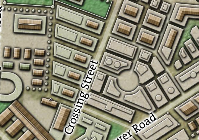
  • This includes a Tithe Payment of Rent: The boy apprentices of the Red Company of Surveyors are housed in the Vladaam apartments on Crossing Street in Oldtown.
  • GM Note: This is not the apartment building occupied by chaos cultists in Night of Dissolution, but one of the neighboring buildings. See Part 15: Oldtown Apartments.

AREA 6 – MAP LIBRARY

This library contains detailed charts of the Whitewind and Southern Seas, but also maps of Palastan, Cherubar, the Plains of Rhoth, the Sea Kingdoms, Ren Tehoth, the Plains of Panish, the Prustan Peninsula, and even the distant lands of Uraq.

ACCESS: The guild charges 100 gp for access to the map room. There is an additional copying charge per map. (These maps represent valuable commercial intelligence.)

LIBRARY: The library grants a +2 bonus to navigation- and geography-related checks.

TREASURE HUNT: A conjoined DC 16 Intelligence (Investigation) and DC 20 Wisdom (Survival) check requiring 1d6 days per check can allow a researcher to turn up a map to a potentially interesting location.

HIDDEN SWITCHES: There are six hidden switches located around the room. If activated in the correct sequence, they open the 4-ft. thick stone wall leading to Area 7. If activated in an incorrect order, a magical trap is triggered which summons a chain devil and sends a mental alarm to Guildmaster Essetia.

  • DC 10 Intelligence (Investigation): To find one of the six hidden switches.
  • DC 14 Intelligence (Investigation): To find two of the six hidden switches.
  • DC 20 Intelligence (Investigation): To find all six hidden switches.
  • DC 25 Intelligence (Investigation): To realize there’s a trap triggered with an incorrect activation sequence. A second DC 25 Intelligence (Investigation) or a DC 16 Intelligence (Thieves’ Tools) check can determine the correct sequence.

AREA 7 – ENTRANCE TO THE INNER SANCTUM

Lit with red everburning torches, this stairwell hidden within the wall of the guildhouse leads to Area 1 of the Inner Sanctum.

AREA 8 – GUILDMASTER’S QUARTERS

DOOR – MAGIC MOUTH: A gargoyle on the door will animate and speak to anyone approaching, passing messages to Essetia if she’s inside. If Essetia is not present, the gargoyle will “take a message” and give it to her when she returns.

  • Door (Strong Wood): AC 15, 27 hp, DC 24 Dexterity (Thieves’ Tools)

SITTING AREA: Comfortable chairs with griffon-carved backs and a bed of luxurious feather-down. Large windows look out onto the balcony.

WRITING DESK: The top is closed and locked, requiring a DC 14 Dexterity (Thieves’ Tools) check. The desk contains:

  • Correspondence Regarding the Hand of Malkith
  • Report Concerning the Erthuo/Sadar Affair
  • An engraved box of oak containing a cutting from a tree (papery-thing, silver-grey bark and white wood) and Letter from Essetia to Ulloth.
  • A red pouch containing 150 pp and Letter of Thanks from Godfred Vladaam.

DC 12 Intelligence (Investigation): A chest is hidden under the bed.

  • 469 gp
  • potion of fire shield
  • scrolls (see invisibility, mage hand, feather fall)
  • Oath of the Brotherhood of Yrkyth

IRON COFFER: 10% chance of being present.

  • 500 gp
  • 40,000 sp
  • 50,000 cp
  • Instructions to have the Ithildin Couriers ship to the Red Company of Goldsmiths on Gold Street (see Part 12).

AREA 9 – GUILDMASTER’S BALCONY

The balcony encircles the entire third floor of the guildhouse. A beautiful view of the city and out across the Whitewind Sea on one side, and across Oldtown towards the Nobles Quarter and the Spire in the other direction.

TRIPODS: There are two tripods set up on this balcony. One contains a sextant, the other a telescope. The guildmark on each of them marks them as creations of the Red Company of Founders (sees Part 11).

Go to Part 14B: Inner Sanctum of the Surveyor’s Guild

Archives

Recent Posts


Recent Comments

Copyright © The Alexandrian. All rights reserved.