When you’re remixing published material you are, of course, deviating from the original version of the material: Some stuff will be thrown out. Some stuff will be changed. Some stuff will be added.
In addition to changes in the text (which are easy enough to do), this can also impact the graphical elements of the scenario. For example, the Alexandrian Remix of Dragon Heist added the idea that the Stone of Golorr would be missing its three eyes when the PCs discover it. Since this wasn’t the case in the original adventure, all the published images of the Stone naturally featured it having all three of its Eyes.
This can, obviously, also affect maps: Once you start adding new locations or moving locations around, the map is, ipso facto, changing.
When this is GM-facing material, this is relatively trivial to deal with: Just jot a quick note or scribble something onto the map to remind yourself of the change. For example, when I sketched up the point-map of Elturel, I didn’t worry too much about places where the published map had minor deviations from the Remix material. It was close enough for the GM to use it without any confusion.
When it comes to player-facing material, on the other hand, you may want to make a greater effort to seamlessly align what they’re seeing with what you’re describing. For example, you might Photoshop the image of the Stone of Golorr to show it in its blinded state so that you can use it as a handout for the players without having to say, “It looks like this, except it’s missing these bits.”
THE MAP OF ELTUREL
In the case of Elturel, we’re planning on handing the PCs a beautiful poster map of Elturel. We’re also adding a bunch of new material to the city. How can we align those things?
First, when adding locations to the city you can scan the map and try to identify existing buildings that are close enough to the location you’re adding. For example, I knew that Symbril’s House fronted the Garden, so I just looked along the edge of the Garden until I found a building that “fit” my image of Symbril’s House. Similarly, I wanted Helm’s Shieldhall to be located in the northwest section of the city. So I scanned the whole region until I found a compound that I felt was close enough to what I wanted.
Finding buildings on a beautifully detailed map like Jared Blando’s map of Elturel can also feed back into the location itself. For example, the look and location of the building I identified for the Old High Harvest Home inspired my vision of the old temple having a huge balcony/patio on every floor looking out over the lower city.
But sometimes that can only take you so far. That’s when you either need to:
- Simply say something like, “You won’t see this on the map, but…” or “This is a little bit different than what the map shows…” (And this is frequently just fine. Players are flexible and they recognize that the map is not the territory.)
- Fire up good ol’ Photoshop.
If you recall, we did this previously with the Poisoned Poseidon in Baldur’s Gate. Now we’re going to do it again with a handful of locations in Elturel.
USING THE PATCHES
For obvious ethical and legal reasons, I’m not going to present a high-resolution version of the full Elturel map with these changes made to it. Instead, I’m going to offer small patches that can be easily added to your copy of the map using any image manipulation program.
To make this process as seamless as possible, you should buy a digital copy of Jared Blando’s map from his online store. The patches I present below maintain the same resolution, so you should be able to align them onto the image with just a few seconds of work.
(You can get versions of the map at considerably lower resolutions through various VTT packages, but it will be harder to seamlessly apply the patch.)
KEEP OF THE TWIN SUNS
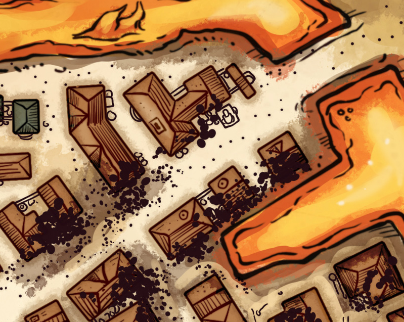
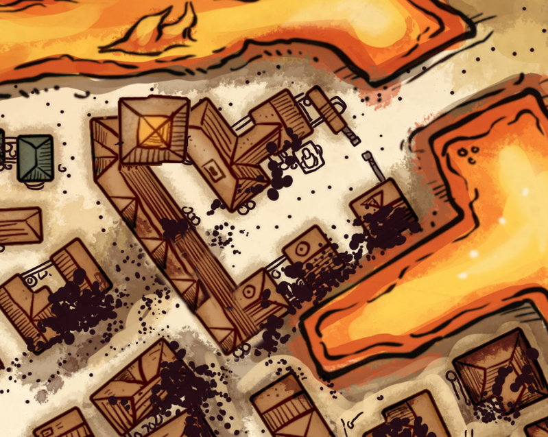
Let’s start with the Keep of the Twin Suns. I placed this just inside the Dusk Gate on the east side of the city and described it as arching above the street to act almost like a second gatehouse.
You can see here how I simply expanded the existing buildings to make structure more explicit.
MAIDEN’S LEAP
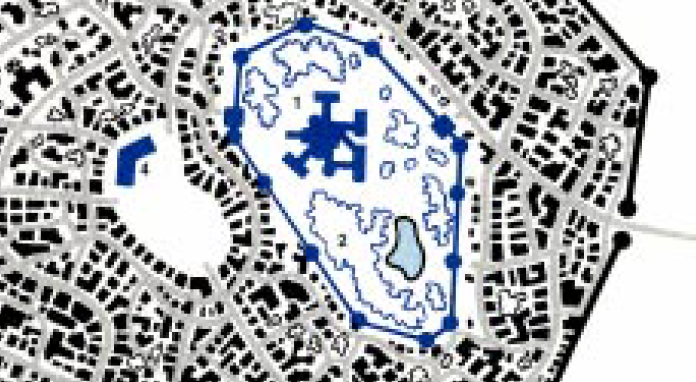
If you look at the older reference material for Elturel, you’ll discover references to the Maidens’ Leap or Maiden’s Leap: A waterfall at the north end of the High District that cascades down into a lake below that flow into the city’s canals. I thought this was cool and actually worked that image of High Watcher Bellandi leaping from the Maiden’s Leap into the Night of the Red Coup before belatedly noticing that the cliff face had been eliminated from the new map.
If you look at the digital version of the map WotC scanned from Forgotten Realms Adventures, it’s pretty easy to see how this happened:
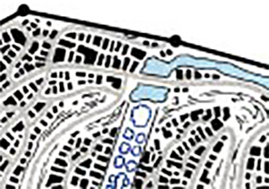
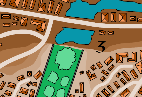
Although the falls are keyed (#3), it does sort of look as if you could just walk around the lake and up into the Gardens. The Forgotten Realms Interactive Atlas makes it clear, however, that this is not the case:
(A version of Elturel where the Gardens actually DO slope down through the High District bluff, with cliff walls to either side of the Gardens getting higher and higher the father north you go is also potentially cool. But the Hellturel map doesn’t really depict that, either.)
In any case, this patch should be sufficient to make it clear to the players that their PCs can’t just walk up into the High District from the north side (without climbing a sheer cliff).
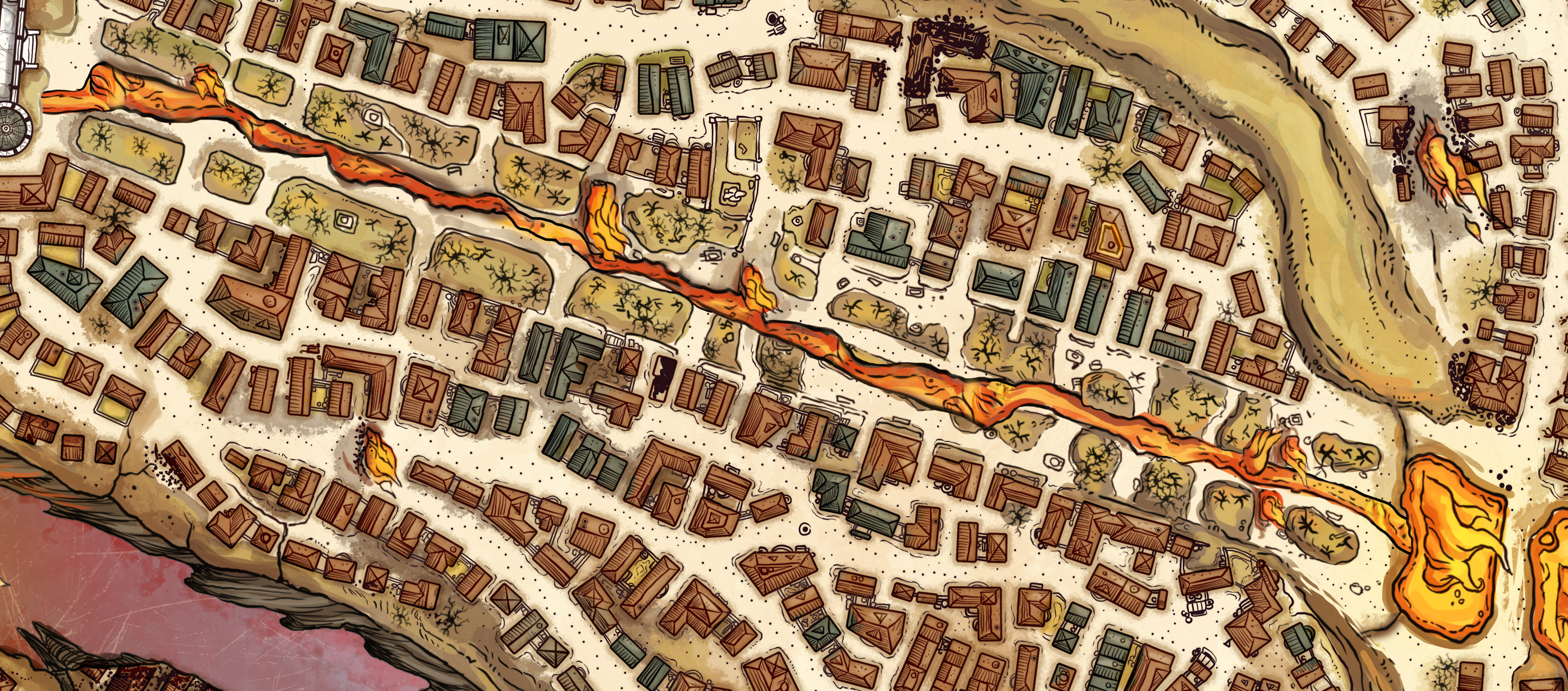
THE CANAL
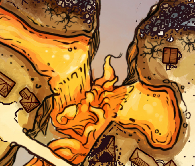
A key question for me looking at the map of Hellturel was, “Where is the lava coming from?” I decided to answer that question by postulating that the spring beneath the High Hall had been fiendishly transformed by the transition to Avernus so that it now spewed lava instead.
However, the original map depicted lava pouring into the rift from both sides, thus negating the explanation for how lava was reaching the east side of the city.
This was my solution: The rift must have been created during the Spellplague (for reasons previously discussed in the Remix), and it follows logically that the Elturians must have built a canal bridge spanning the rift in order to keep water flowing into the canals. Ergo, the lava could just cross this same canal bridge and continue into the Dock District canals.
Someone with better Photoshop skills than I could probably make this idea more explicitly clear on the map itself. But this patch is enough for my purposes.
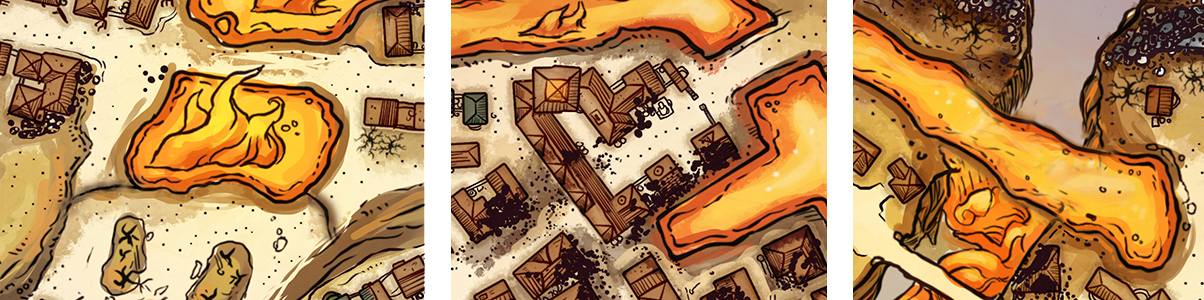
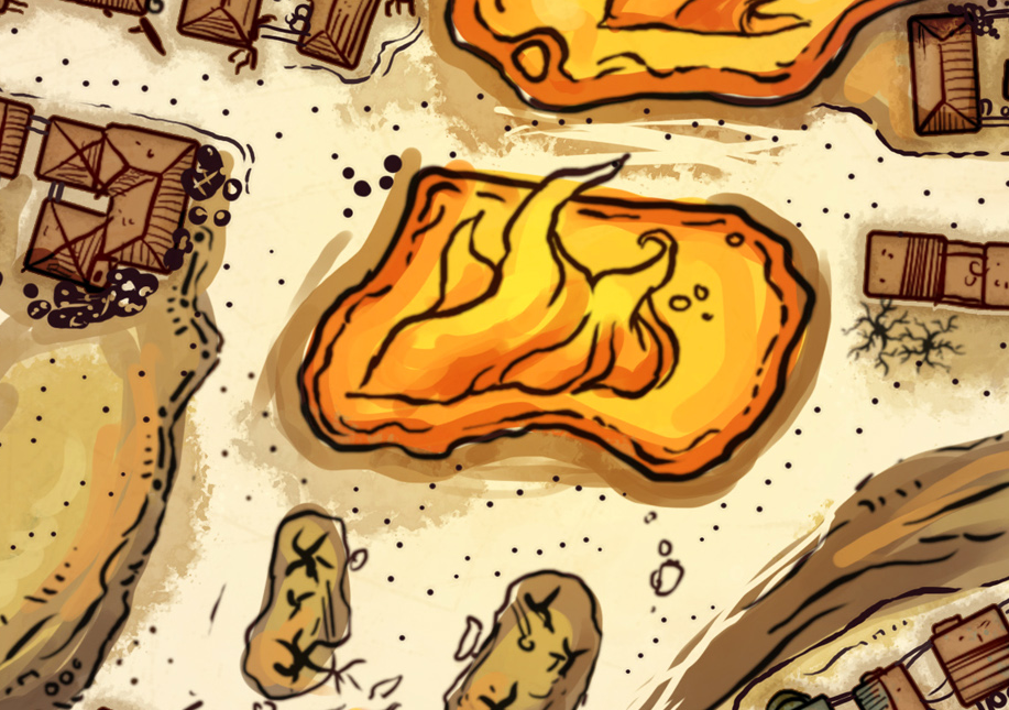
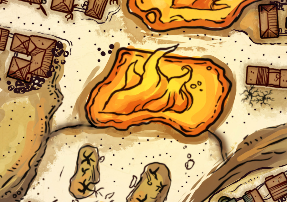
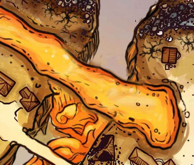
THE RIVER OF FIRE
Speaking of the lava spring beneath the High Hall, I wanted to add the river of lava running down the center of the Garden because… well… it’s awesome.
The Maiden’s Leap is included in this patch. I present it separately above for anyone who wants to keep the cliff face but is indifferent to the river of fire.
THE DOCK WALLS
Finally, here’s something that I decided to just leave alone.
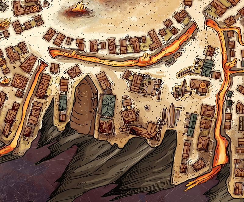
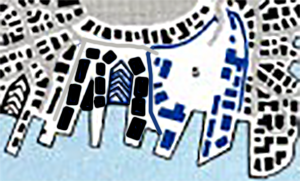
See those rivers of lava? They really shouldn’t be rivers of lava.
If you look at the original maps of Elturel, it’s once again not hard to see what happened:
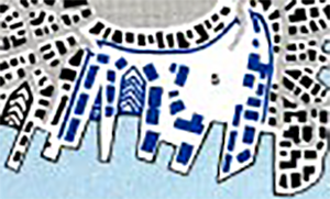
Those blue lines were interpreted as water. But they’re not: Those are the walls around the Dragoneye Dealing Coster. That bright blue color is used throughout the Forgotten Realms Adventures to denote walled compounds and major structures (that’s why the buildings are also bright blue). You can see a similar example on the map of Daerlun a few pages earlier, for example:
Why not fix it?
Several reasons:
- I felt the amount of work required to revise the map outweighed any potential gain.
- I don’t think my Photoshop skills are good enough to make the alteration aesthetically seamless. (I would compromise the quality of the map.)
- I don’t think it matters that much. Whether it’s lava canals or a wall, the place is geographically distinct and somewhat fortified. This isn’t a major focus of the scenario for me.
- I, personally, think the walled Dragoneye Coster compound is probably about two times larger than it should be compared to the rest of the docks. (I want room for there to be some other coster companies, too, plus some independent operators.) I’d be happier with something like this (where the Dragoneye still have personal access to the Market, but they don’t chew up the entire dock front):
Your mileage might vary on any of these, of course.


“The rift must have been created during the Spellplague (for reasons previously discussed)”
What reasons were those again? I can’t remember which of the previous articles mentioned the Spellplague.
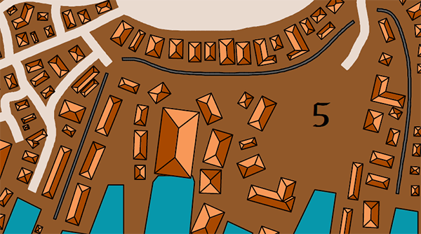
Also, any idea what the object is that’s marked with chevrons on the (original) map of the docks (in the new version, it’s a muddy brown patch). Is it meant to be a dry dock, perhaps?
@Wyvern In the article “A Textural History of Elturel” Justin said;
“A ravine has been added to the east side of the bluff. (You may, at first glance, assume this to be an apocalyptic scar, but the text confirms that the bridges of Torm’s Blade and Torm’s Reach crossed a ravine here before Elturel went to Hell. A direct comparison also reveals that the streets around the bridges have been redrawn to accommodate them. If you wanted to explain this diegetically, we could perhaps theorize that the ravine was the result of damage inflicted during the Spellplague.)”
As for the area marked by chevrons it certainly looks a drydock. If you Google image search for Portsmouth Dockyard 1864 you can see maps that use drydocks tapered to fit the prow of a ship in the same manner.
I simply do not see where in any of the old source material there are *two* bridges across the Western and Eastern parts of the city. I can see one. To make matters worse, the new map seems to imply that Elturel sits neatly on a flat disk of land, which just conflicts with every part of the old material.
I am so confused. I have half a mind not to give my players a map of pre-1492 Elturel because it would just confuse them.
@Mark: Neither Torm’s Blade nor Torm’s Reach bridges existed in the 14th century. As discussed in the text here (and in the comments above yours), the ravine they cross didn’t exist in the original map (and it can by hypothesized it was created during the Spellplague).